Menu


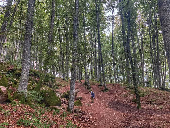
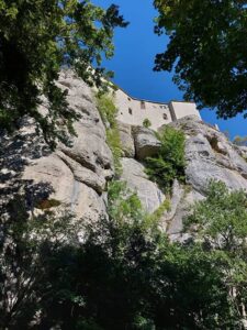
Up, down, and back up again. Stage 6 of the Via di Francesco starts with a rocky climb up Poggio della Cesta, and then gently guides pilgrims past Frassineta church and mountain farmstay Rifugio Casa Santicchio down to the town of Rimbocchi. Pilgrims can refill water here, and then start the forest climb to the Sanctuary of La Verna. The sacred forest embraces pilgrims unlike any other forest passage thus far. And finally, you will arrive at the most beloved place of St Francis, the Sanctuary of La Verna.
Stage 6 Highlights
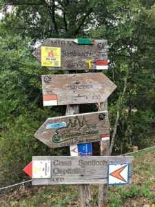
- Rifugio Casa Santicchio
- Sacred Forest of La Verna
- Santuario della Verna
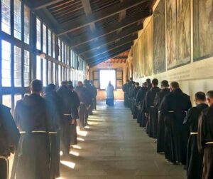
- Chapel of the Stigmata
- 15:00 Procession at Monastery of La Verna
Difficulty
Difficult. Today is the most challenging of the first six stages. Expect hard walks for around 8 hours or more.
Microclimate
Today’s walk climbs to mountain peaks, then to valley floors, and back up again. Wear easily changeable layers to manage climate and humidity changes.
Navigation
Pilgrims will meet several alternative routes and crossroads into La Verna. Plan ahead which route you will take, and then follow the signs and GPX.
Food
There is no food on the trail. It’s possible to stop for a snack or water at Rifugio Casa Santicchio about halfway. Or just stay overnight! The Monastery at La Verna features a coffee shop and serves dinner to pilgrims who sleep there.