Stage 2: Pontassieve to Consuma

Pontassieve to Consuma

Today’s stage is an uphill trek through picturesque vineyards and lush forests. Start early from Pontassieve to see the morning sun illuminate hilly vineyards and reach Diacceto for a coffee at Locanda Tinti. Then, pilgrims will pass by ancient Castello di Ferrano, and then get their first taste of the mystical solitude of the Via di Francesco by entering the forest of Vallombrosa.

The densely wooded trail climbs to Consuma in silence. Pilgrims will walk the last km along a busy roadway into the small village of Consuma. You’ll have earned a good rest. Try local delicacy “la schiacciata con i funghi ” at Ristorante Consumi.

Steep climbing in Stage 2
Steep climbing through forest in Stage 2

Stage 1: Florence to Pontassieve

Stage 3: Consuma to Stia

GPX Maps

We strongly recommend pilgrims use offline GPX to navigate the trails.

Quick Glance

Start:
Pontassieve, Piazza Vittorio Emanuel II
Finish:
Consuma, Chalet Il Valico
Distance:
18.6 km 
(11.6 mi)
Travel Time:
6 hours
Total Ascent:
1138 meters
Total Descent:
138 meters
Trail Surface:
Two-thirds concrete road, then woodsy trails
Trail Signs:
Sparse. Yellow Tau on white background begins to appear.
Water Sources:
Coop market in Diacceto. Fountain after Ferrano.
Food:
Pilgrims can stop for cakes, coffee, or snacks in Diacceto (6 km from stage start)
Navigation Notes:
Enter Vallombrosa forest trail just after passing small abandoned chapel on right. The trail entrance is easy to miss.
Services at Stage Destination:
Restaurants, Market inside Ristorante Consumi
Quick Links

Preparation

Breathtaking view of the Tuscan hills outside Diacceto right before the trail goes through the forest
Breathtaking view of the Tuscan hills outside Diacceto

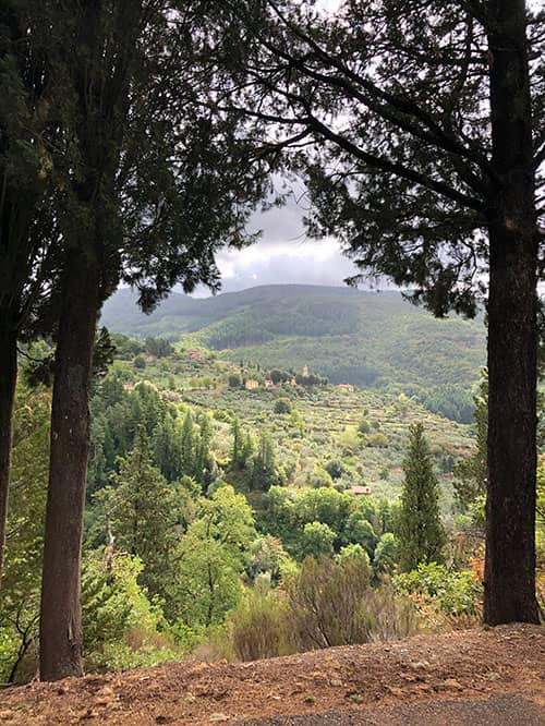
Welcome to Stage 2. Pilgrims go through forest walks and its steep climbs today before reaching the small mountain town of Consuma. We recommend hiking poles for the steep climbs.

Stage 2 Highlights

Difficulty

Today is the first tough climb through the forests of the Via di Francesco. Take your time with the steep ascents in the second half.

Microclimate

Temps cool off once pilgrims reach the shade of the forest.

A small chapel right on the trail before reaching the trailhead

Navigation

Pay attention to the trail entrance after passing the Chiesa di Santa Maria a Ferrano. Pilgrims should spot a small chapel before reaching the trailhead. Make sure your apps work offline, as phone service can be spotty.

Stamps

You can get your stamp for morning breakfast / lunch at Locanda Tinti in Diacceto.

Food

Pilgrims can get breakfast in Diacceto at Locanda Tinti, and they can get snacks at the Coop market nearby. The next food is at stage 2’s end in Consuma. Consuma features a couple bars with appetizers, snacks, and pastries. A famous dish in Consuma is the “Schiacciata con i Funghi” at Ristorante Consumi. Ospitale San Domenico hosts a communal pilgrims dinner with local food and wine.

Step-By-Step Instructions & Itinerary

Stefano is giving pilgrims stamps (timbros) at Locanda Tinti

Step-By-Step: Stage 2

Strong Recommendation: Use the official GPX files in addition to these instructions to not miss any turns. As signs are sparse, it can be easy to miss one.

  1. From Piazza Vittorio Emanuele II, turn right onto Via Tanzini and pass under the clock tower. Turn right onto Via Ghiberti and continue straight, passing Piazza XIV Martiri and crossing the Sieve River via the bridge.
  2. Turn right at the first intersection onto Via IV Novembre and continue straight onto Via Della Farulla, crossing Via Forlivese and onto Via Tirolo.
  3. Follow the trail signs for CAI 15 and the yellow-blue signs for the Cammino di Francesco, climbing for about 2.9 km passing under the Castello di Nipozzano and through the vineyards of Frescobaldi.
  4. Continue following the yellow-blue signs until you return to the asphalt road in Diacceto (6 km traveled). Continue on the main road, passing through the town and following the signs for Ferrano.
  5. You will soon find the yellow-blue and white-red CAI 21 trail signs that you can follow peacefully for the next 4 km until you reach the Chiesa di Santa Maria a Ferrano (9.1 km traveled).
  6. After the church, continue until you find the CAI 11 trail signs with a time estimation for Consuma (1.45 hours). Follow this path through the forest of Vallombrosa and the localities of Lagacciolo and Podernuovo, until you return to the asphalt road.

    Trail entrance on your left. Many pilgrims who do not use GPS app miss this mark and walk pass it.
    CAI 11 Trail Signs: Notorious spot that many pilgrims miss. The trail entrance is on your left. If using a GPS App, you will be able to follow along easily. Many pilgrims who do not use GPS app miss this mark and walk pass it.
  7. Turn left and continue on the road until you reach the lake near an abandoned restaurant (Google Maps).
  8. Follow the CAI 6 trail signs and path until you reach Consuma.
  9. Keep an eye out for a thin steep trail that shortcuts up to SR70 highway.
  10. When you reach SR70, follow the left shoulder about 800m into the center of Consuma. There are no sidewalks into town.

About Consuma

Consuma is a true gateway into the Via di Francesco. Standing at the entrance of the Apennine Mountain pass, Consuma caters to visitors exploring the nearby Casentino National Park via the two-lane SR70. Check out the beautiful murals inside the Church of San Domenico, built in 1932 on the site of a 16th-century chapel.

Church of San Domenico
Church of San Domenico in Consuma

What’s Next: Stage 3

Stage 3: Consuma to Stia

Less strenuous, downhill walk into the beautiful town of Stia, the biggest village on the Via di Francesco between Pontassieve and La Verna.

Accommodations

Ospitale di San Domenico greets pilgrims in the heart of Consuma. Call ahead to reserve a place for dinner. Pilgrims may also choose to walk further to the hotel just beyond the crest of town.

Pilgrim Ospitale Member / Pilgrims' Discount
Breakfast Included
Dinner Available
Good for Groups
Diacceto, 
12.6 km from the end of stage
€70
Diacceto, 
11.8 km from the end of stage
€40-€60
Consuma, 
1 km from the end of stage
€41
Consuma, 
0 km from the end of stage
€70-€100
Montemignaio, 
6.6 km from the end of stage
€20 - €30

Other Stages

Distance: 18.9 km
Travel Time: 6 hours
Elevation: 495 meters
Trail Surface: Concrete sidewalk, gravel trail, some concrete road
Distance: 18 km
Travel Time: 6 hours
Elevation: 462 meters
Trail Surface: Forest trail, loose big rocks on descending path. Need poles.
Distance: 17.5 km
Travel Time: 6 hours
Elevation: 910 meters
Trail Surface: Forest trail, Casentinesi Forest, Uphill
Distance: 8.3 km
Travel Time: 3.5 hours
Elevation: 515 meters
Trail Surface: Forest trail, fern forest, Casentinesi National Park
Distance: 17.8 km
Travel Time: 8 hours
Elevation: 1182 meters
Trail Surface: Rocky mountain, forest trail, Sacred Forest

Printable Wakling Guide

Get printable Walking Guide for Stages 1-6 as a part of the Pilgrim Essentials Kit.

Enter your email to receive the free kit, including Walking Guide, Accommodations Guide, pilgrim Quick Start email series, and more.