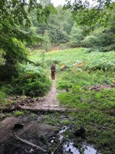
Using a GPS app on the Way of St Francis is super helpful.
Avoid Getting Lost: The Best GPS Apps for St. Francis Way Pilgrimage
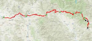
The Way of St Francis is a popular trekking route for people who love history, nature, and a bit of spirituality. However, trekking the trail can be challenging, especially if you’re not familiar with the terrain. That’s where GPS apps come in.
Using GPS apps while trekking the Via di Francesco trail is essential because it can help you navigate the route, stay on track, and avoid getting lost. Poor signage and other risks and challenges make using GPS apps even more important. Let’s explore the benefits of using GPS apps while trekking the trail.
Table of Contents
Top 5 Best GPS Apps for Trekking the St. Francis Way Pilgrimage
Using a GPS app on the Way of St Francis is super helpful.
If you’re planning on trekking the St. Francis Way Pilgrimage, using a GPS app can help you stay on track, avoid getting lost, and make the most of your journey. Here are some of the best GPS apps you can use while trekking the St. Francis Way:
AllTrails: This app is perfect for those who want to discover new trails and connect with a community of fellow hikers. AllTrails provides detailed maps and GPS navigation that can help you find your way along the St. Francis Way.
Wikiloc: Wikiloc is another popular GPS app that offers a wide range of trails for hikers, bikers, and outdoor enthusiasts. You can use Wikiloc to download maps and find your way on the St. Francis Way even if you don’t have an internet connection.
Komoot: This app provides voice-guided navigation, which is especially helpful if you’re hiking alone. With Komoot, you can plan your route in advance and customize it according to your preferences.
GAIA GPS: GAIA GPS is perfect for the more adventurous trekkers who want to explore off the beaten path. The app provides detailed topographical maps, which can help you navigate through difficult terrain and challenging environments.
OsmAnd: This app offers offline maps that can be downloaded in advance, which is perfect if you’re traveling to areas with limited internet connectivity. OsmAnd also provides detailed information on points of interest and other useful information along the St. Francis Way.
We chose these GPS apps because they are amongst the easiest to use, have excellent support, and are available for both iOS and Android. Additionally, they offer both free and paid plans, allowing users to choose the option that works best for them. We found that these apps are the least complicated to use, making them ideal for those who may not be familiar with GPS navigation. So whether you’re an experienced trekker or a novice, these apps offer the necessary tools to navigate the St. Francis Way Pilgrimage with ease.
6 Essential Features of GPS Apps
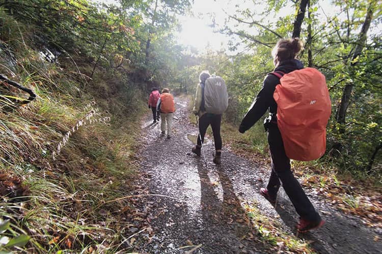
St. Francis Way especially from Florence to La Verna trail passes through one of the most Italian’s sacred National Forest. Having a GPS app with offline map is essential.
When it comes to trekking the St. Francis Way Pilgrimage, having a reliable GPS app can make all the difference. Here are some essential features to look for in a GPS app for your pilgrimage:
Offline Maps – Offline maps are essential for areas with poor network coverage. The AllTrails and Wikiloc apps offer offline maps, ensuring that you won’t get lost even if you don’t have a data connection.
GPS Tracking – GPS tracking is a must-have feature for any trekking app. With this feature, you can track your location, distance, and speed. All of the apps listed above have GPS tracking capabilities.
Navigation Features – Navigation features such as turn-by-turn directions and waypoints are useful for staying on track during your pilgrimage. Komoot, GAIA GPS, and OsmAnd all have reliable navigation features.
Compass – A compass is helpful when navigating the St. Francis Way Pilgrimage, especially when you’re in mountainous areas. All of the apps listed above have a compass feature.
Elevation and Altitude – Knowing the elevation and altitude can help you prepare for steep climbs and descents. AllTrails, Komoot, and GAIA GPS offer this feature.
Battery Life – Finally, battery life is crucial when using a GPS app. All of the apps listed above have both free and paid plans that offer different battery-saving options.
With these features in mind, any of the GPS apps listed above would be a great choice for trekking the St. Francis Way Pilgrimage.
Make GPS Apps More Useful with GPX
GPS apps are essential for navigating the trail. However, just having a GPS app is not enough.
These apps require GPX files to function properly. GPX (GPS eXchange Format) files are a type of file that contains information about the trail, including GPS coordinates, altitude, and other important details.
Pilgrims and hikers cannot just use the GPS app without the GPX files, as the app will not have the necessary information to guide them on the trail.
To make it easier for hikers, we provide the GPX files for the route from Florence to La Verna, which can be downloaded and added to your preferred GPS app.
With these files, hikers can be sure that they have all the necessary information to make their pilgrimage as smooth and enjoyable as possible.
What Are GPX Files and How to Get Them on Your Phone
Definition of GPX Files
GPX files, or GPS eXchange format files, are a type of file that contains location data in the form of latitude and longitude coordinates.
How GPX Files Work
GPS apps use GPX files to display and navigate routes, as well as to track and record the user’s progress along the way. By providing a route in the form of a GPX file, users can easily follow the designated path without the need for an internet connection.
Advantages of Using GPX Files
One of the main advantages of using GPX files is that they provide a more accurate and reliable route compared to traditional maps. They are also more detailed, allowing for better navigation, especially in remote areas where traditional maps may not have sufficient detail.
Downloading GPX Files
To download GPX files, visit our GPX page. You can download the official GPX files there, or open them directly with links to AllTrails and Wikiloc. You can search for alternative routes on the recommended apps, but we advise using only GPX files from official sources and recommended guidebooks, as trails can be outdated and routes can change annually.
Transferring GPX Files to Your Phone
Pilgrims can transfer GPX files to their phone by uploading the files to the websites of the recommended apps. For most apps, this requires using a desktop computer beforehand to upload the GPX file to the website. Some apps do allow for GPX files to be added directly on the phone, such as GAIA GPS and OsmAnd.
For each app listed on our GPX page, we’ve linked instructions for adding the official GPX files.
Common Mistakes to Avoid with GPS and GPX
Common mistakes can render GPS apps and GPX useless or, worse, dangerous. First, it is easy to rely too heavily on technology and fail to bring backup navigation tools. This can be especially problematic if your phone battery dies or you lose signal.
Another mistake is not downloading maps and trails ahead of time. Some apps require a data connection, which can be unreliable in remote areas. Neglecting to manage phone battery life is also a mistake. GPS apps can be battery hogs, so it is essential to have a power bank or other backup source. We also recommend hiking with your phone set to “Airplane Mode” to save battery, and avoid interruptions to your hike.
Hikers should also avoid using GPS apps in areas with poor reception or without the necessary understanding of how to use GPX files. Updating GPS app software and maps is crucial for accuracy and reliability.
Finally, it is important to consider weather and terrain conditions and not to rely solely on GPS and GPX for navigation in extreme conditions. By avoiding these mistakes, hikers can make the most of their GPS apps and enjoy a safe and successful trek along the Via di Francesco.
Check the forecast for the entire route ahead of time and pack accordingly
Tips for Trekking the St. Francis Way Pilgrimage
Trekking the St. Francis Way Pilgrimage is a wonderful experience that requires some planning and preparation. To make the most of your pilgrimage, there are some tips that can help you navigate the trail safely and efficiently.
Weather Preparedness
One of the most important things to consider when trekking the St. Francis Way Pilgrimage is the weather. It’s essential to check the forecast for the entire route ahead of time and pack accordingly. Wearing appropriate clothing and footwear will help you stay comfortable and avoid hypothermia, heatstroke, or other weather-related illnesses. Remember to bring a waterproof layer to stay dry in case of unexpected rain.
Accommodation Planning
It’s important to have a plan for accommodation ahead of time while trekking the St. Francis Way Pilgrimage. You can plan to stay in hotels, hostels, or inns, but keep in mind that some of these places fill up quickly, and you may need to book ahead. If you’re on a tight budget, note that camping outside of sanctioned campsites is illegal in Italy. Consider staying at a donativo, church, or related place. Check our accommodations listings for places known for pilgrim hospitality.
Cultural Sensitivity
The St. Francis Way Pilgrimage is a sacred and spiritual journey, and it’s important to show respect to the culture and heritage of the people you’ll encounter along the way. Learning simple Italian phrases can go a long way for opening unexpected doors and opportunities along the trail. Dress modestly while in churches or religious sites. Remember to follow the guidelines and traditions of the churches you visit, and to maintain silence in areas where silence is expected.
Editor’s Note: Check out the church along the way.
Health and Safety
Trekking the St. Francis Way Pilgrimage can be physically and mentally challenging, so it’s important to be in good health and shape. You can also consult your doctor before your pilgrimage if you have any medical conditions that could affect your journey. Remember to carry a first aid kit, water, snacks, and sun protection. Finally, be aware of your surroundings and follow safety guidelines to avoid accidents.
Other Helpful Resources
It’s essential to have access to the right resources to make the most of your journey. In addition to GPS apps and other navigation tools, there are other resources available that can enhance your pilgrimage experience.
Official Guidebooks and Maps
There are several official guidebooks and maps available for the St. Francis Way pilgrimage. These books provide detailed information about the route, including landmarks, historical and cultural information, and suggested places to stay. Some guidebooks also include maps, making it easy to navigate the route.
Local tourist offices are an excellent resource for anyone planning to trek the St. Francis Way. These offices can provide information about the route, including any changes or closures, as well as information about local events and places to stay. Tourist offices may also have maps and other resources available for pilgrims.
Online Forums and Communities
Finally, online forums and communities are an excellent resource for anyone planning to trek the St. Francis Way. These forums allow pilgrims to connect with others who have completed the route or are currently in the process of doing so. Pilgrims can share tips, ask questions, and connect with other like-minded individuals. Additionally, online communities may provide access to detailed route information and additional resources, making it easier to plan your pilgrimage.
Trekking the Way of St. Francis Pilgrimage Trail is a fulfilling experience that combines adventure and spiritual reflection. The trail spans over 600 km from Florence to Rome, passing through some of the most beautiful and historically significant towns and cities in Italy.
While there are many ways to navigate the trail, using GPS apps can enhance the experience by providing detailed maps, real-time location tracking, and useful information about points of interest along the way. AllTrails, Wikiloc, Komoot, GAIA GPS, and OsmAnd are just a few examples of apps that can help make your journey more enjoyable and manageable.
We encourage all pilgrims to take advantage of the available resources, including guidebooks, maps, and local tourist offices. Online forums and communities are also great places to connect with fellow trekkers and share tips and advice.
Finally, we hope that this article has inspired you to embark on this pilgrimage and that the information provided has been helpful in planning your journey. Safe travels and may the spirit of St. Francis guide you on your way.
Where to Sleep? Private hosts, donativos, monasteries, agriturismos and hotels are spread throughout the Tuscan stages to house and feed pilgrims. Pilgrims will enjoy rustic accommodations, simple and delicious food, and immersion within the Casentinesi forests. Pilgrims are encouraged to book nightly stays they day before or in the morning. Availability may be limited by season, local events, and the number of pilgrims on the trail. Alert hosts early of any dietary restrictions. ACCOMMODATION BY STAGE Stage 1: Florence to PontassieveStage 2: Pontassieve to ConsumaStage 3: Consuma to StiaStage 4: Stia to CamaldoliStage 5: Camaldoli to Badia PratagliaStage 6: Badia Prataglia to La Verna Printable Accommodations List Accommodations by Stage Stage 1: Florence to Pontassieve Lodging in Pontassieve can be tight. Consider alternative end points of Compiobbi or Diacetto. Book first 1-2 stages before leaving Florence. Read more about Stage 1 Accommodations > Pilgrim Ospitale Member / Pilgrims’ Discount Breakfast Included Dinner Available Good for Groups Stage 2: Pontassieve to Consuma Consuma is the gateway to the mountain stages. Book day of or night before. Ospitale di San Domenico offers pilgrim’s dinner. Overflow can stay at nearby hotel. Read more about Stage 2 Accommodations > Pilgrim Ospitale Member / Pilgrims’ Discount Breakfast Included Dinner Available Good for Groups Stage 3: Consuma to Stia Stia provides apartment stays, B&Bs and hotels. Book your stay on day of hike or night before. Wonderful town for rest, food re-supply, and ATMs. Read more about Stage 3 Accommodations > Pilgrim Ospitale Member / Pilgrims’ Discount Breakfast Included Dinner Available Good for Groups Stage 4: Stia to Camaldoli Sleep in the Casentinesi Forests National Park. Contact Camaldoli Monastery during Stage 2 or earlier to arrange a stay at the Foresteria. Read more about Stage 4 Accommodations > Pilgrim Ospitale Member / Pilgrims’ Discount Breakfast Included Dinner Available Good for Groups Stage 5: Camaldoli to Badia Prataglia Badia Prataglia is a great resort town for rest. Book your stay on day of hike or night before. Rifugio Casanova is only open on Weekends. Read more about Stage 5 Accommodations > Pilgrim Ospitale Member / Pilgrims’ Discount Breakfast Included Dinner Available Good for Groups Stage 6: Badia Prataglia to La Verna Consider breaking this stage up to stay in Santicchio or Biforco. Book your stay on day of hike or night before. Contact La Verna Monastery the night before to arrange a stay at the Foresteria. Read more about Stage 6 Accommodations > Pilgrim Ospitale Member / Pilgrims’ Discount Breakfast Included Dinner Available Good for Groups Unique Stays Special Experiences on the Via di Francesco Rifugios Sleep at remote and peaceful mountain locations of the Casentinesi Forests. Caretakers offer meals and beds. Rifugios stays Camping Camping is allowed only at registered camping sites. See these unique stays under the stars. Camping stays Foresterias The Monasteries of Camaldoli and La Verna offer pilgrims opportunities to stay overnight at sacred sites, plus meals. Foresterias stay Planning How to Book and Budget Booking Guide When should you book? How do you do it? Booking Guide Budget Guide How much does it cost to walk the Via di Francesco? Budget Guide Pilgrim’s Discount Our member accommodations and eateries offer a discount just for pilgrims. Get Pilgrim’s Discount Sign Up for Accommodations List Download Carry our printable guide to accommodations and suggested eateries on the Tuscan stages of the Via di Francesco. The guide features names, addresses, and prices by stage in an easy, printable format. Download the Pilgrim Essentials Kit
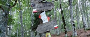
Florence to La Verna Via di Francesco in Toscana Stages From the official starting point in Florence, the path leads you through Tuscan vineyards, into the enchanting Casentinesi Forest National Park, and to the Sanctuary of La Verna. Each stage offers a new adventure and a deeper connection to your self and nature. The 101 km section crosses Firenze, Pontassieve, Consuma, Stia, Camaldoli, Badia Prataglia, and Santuario della Verna. Via di Francesco in Toscana Stages: From Firenze to La VernaClick image to enlarge Tuscan Stages 1 – 6 0 km Walking Trails 0 Stages 0 Days of Walking Tuscany Highlights Here’s the highlights from Stage 1 – 6 Florence The “Jewel of the Renaissance” welcomes pilgrims to visit Michelangelo’s David, The Duomo, and Santa Croce, the world’s largest Franciscan church. See Florence Casentino National Forests Immerse in one of Europe’s largest national forests. The pristine and peaceful trails are unique amongst the other sections of the Via di Francesco. See the National Forests Santuario della Verna The Sanctuary of La Verna is one of the most sacred sites along the trail. Feel the presence of St Francis amongst the caves and forests where St Francis meditated, prayed, and slept. See La Verna Recommended Itinerary: Stages 1 – 6 Day 0: Florence, Rest Easy You’ve arrived at the Jewel of the Renaissance. Grab some food and get some rest. Day 1: Florence, Get Stamp at Santa Croce This is your day to sightsee, eat gelato, and get your initiation stamp at Santa Croce. Once you get your stamp, you’ll be invited to visit special sections inside just for pilgrims. You’ll want to get your stamp today so you can start your journey early tomorrow morning. Day 2: Hike to Pontassieve (18.94 km) Walk along the lazy Arno river, through hilly olive groves, and into the town of Pontassieve. Today’s track gives pilgrims their first taste of Tuscany’s up and down trails. See Stage 1. Day 3: Hike to Consuma (18.6 km) Climb the trail early today so you can stop in Diacceto for a coffee and pastry at the famous Locanda Tinti. Then trek through a rugged forest trail to the mountain town of Consuma. See Stage 2. Day 4: Hike to Stia (18 km) Pilgrims walk downhill to the medieval town of Stia. Use hiking poles to make the descent easier. Pilgrims will be delighted by the food and sleeping options in Stia. It’s a good idea to pick up some supplies at the grocery store here. See Stage 3. Day 5: Hike to Camaldoli (19.02 km) The path leads pilgrims into the Casentinesi Forests National Park, bringing a tranquil and mystical energy to the journey. Today also presents the first big route decision: Walk to the Monastery of Camaldoli, take an alternative route to the remote mountain hermitage, or stop early at Rifugio Asqua in the middle of the stage. See Stage 4. Day 6: Hike to Badia Prataglia (8.3 km) Whether you slept at the hermitage, monastery, or Rifugio Asqua, today’s destination is a relatively relaxing hike. Think of today as an “active” rest day. Most pilgrims will arrive in Badia Prataglia around lunch time, giving plenty of time to recover from the previous hikes. See Stage 5. Day 7: Hike to Santicchio (9 km) Hike back up into the mountains to the remote mountain farmstay Rifugio Casa Santicchio. Pilgrims will enjoy the outdoor spa, wonderful meals, and the peaceful environment. See Stage 6. Day 8: Hike to Santuario della Verna (8.83 km) Start early and take your time as you walk through the enchanting forests surrounding the Monastery of La Verna. St Francis was known to hike these woods and meditate and pray amongst its caves and boulders. Arrive at the monastery before 15:00 to participate in the daily procession. See Stage 6. GPX Maps GPX map files help pilgrims stay on the official route, explore side trips and interesting sites, and locate accommodations. We strongly recommend pilgrims use offline GPX to navigate the trails. Get all GPX Files Get Around Get Around The Trail Signs of the Trail Trail markers and signs come in a variety of sizes, locations, and symbols throughout the Via di Francesco. See the Signs & Markers How to Get to La Verna Want to start your pilgrimage at the Santuario della Verna? Our guide covers train and bus options and shorter walks. See the Guide Bus and Trains Buses and trains can be used to travel throughout different sections of the first six stages. See Bus and Trains FAQs Most Common Questions: Where are the other stages of the Via di Francesco? The Via di Francesco is divided into four sections. Each is managed by an independent regional organization. On this website you’ll find information about Tuscan stages. See information about the other stages here. How do I get to La Verna? Some pilgrims prefer to start at La Verna instead of Florence because of time constraints. See our full guide here. How do I use GPX to navigate the trails? GPX files are digital maps that can be used by GPS apps to navigate the trail. We strongly recommend using official GPX files or GPX files from a recently updated guidebook, as signage is sometimes sparse along the trail. See our GPX page for instructions to use the map files. What accommodations are available in Tuscany? Tuscan stages offer unique experiences not found anywhere else on the Via di Francesco. Stays at monastery foresterias of Camaldoli and La Verna, remote mountain rifugios, and charming b&bs give pilgrims unforgettable days and nights. See accommodations for stages 1-6. Are the first six stages difficult? The first six stages can challenge pilgrims because of steep and rugged mountain trails. However the effort is more than worth it. Recommendation: Take it slow. How do I start the Via di Francesco in Florence? The Via di Francesco starts with the stamp at Santa Croce in Florence. Get your stamp the day before you start your hike. See
GPX Files for Via di Francesco GPX maps are a must for any pilgrim walking the Via di Francesco. Signage can sometimes confuse pilgrims. We strongly recommend pilgrims use offline GPX to navigate the trails. Our official GPX files are updated yearly. Use them for latest trail updates and waypoints for accommodations, water, and special sites. Download GPX Files to Your Device 1 Download Stage 1 GPX 2 Download Stage 2 GPX 3 Download Stage 3 GPX 4 Download Stage 4 GPX 5 Download Stage 5 GPX 6 Download Stage 6 GPX Recommended GPS Apps How to Use GPS App for Via di Francesco Select the app below and follow the instruction.